 Polish Polar DataBase
glaciers facies, glaciers zones, SAR, full-polarimetry, classification
Type of resources
Available actions
Topics
Keywords
Contact for the resource
Provided by
Representation types
Update frequencies
status
-
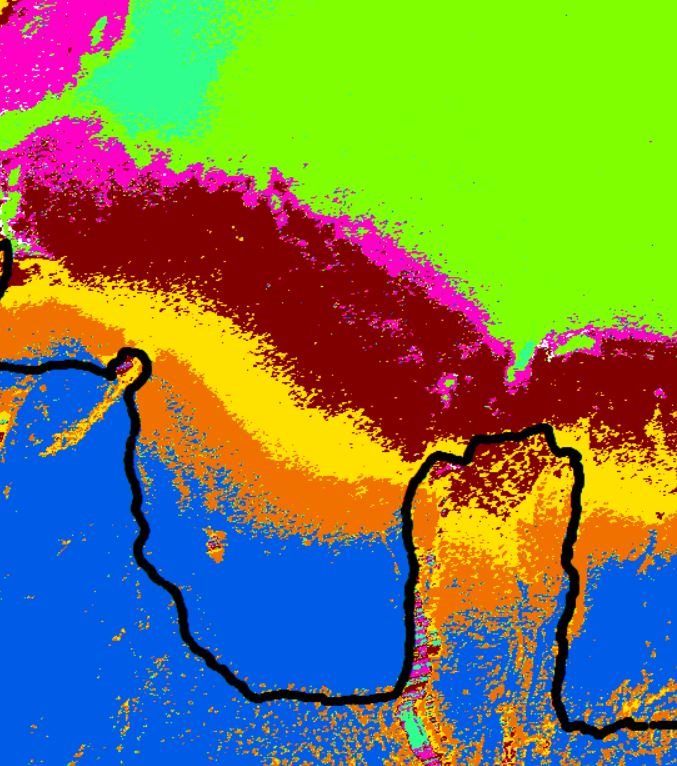
Glaciers facies extents of Langjökull delivered from unsupervised classifications of fully-polarimetric SAR data (ALOS-2 PALSAR, RADARSAT-2) for 2018 year. Date of SAR images acquisitions: 12, 16 Mar 2018 (Fine Quad Pol RADARSAT-2), 17 Mar 2018 (High Sensitive Quad Pol ALOS-2 PALSAR). Method of classification: H-a Wishart Classification. Results validated with terrestrial measurements (shallow ice cores drilling, Ground Penetrating Radar measurements). Research done with cooperation with University of Iceland and supported by the European Space Agency, Third Party Miassions. Overwiew of results of RADATSAT-2 (16 Mar 2018; Fine Quad Pol) classification of south part of Langjökull. Black line - contour of Langjökull; other colours - different scattering properties of SAR microwaves. For more details please contact Barbara Barzycka (bbarzycka@us.edu.pl).